By Carrie Glenn and Camille Cordier
Situated at the corner of rues Royale and Saint-François Xavier in Cap-Français (Le Cap), Saint-Domingue, dwelling number 623 to be exact, was a bakery and shop owned by the widow Lemesle and her son—an establishment where several enslaved people toiled [Figure 1.]. The shop was one of hundreds that contributed to Le Cap’s reputation as the most luxurious town in the French West Indies by the mid-eighteenth century. During the colonial period, Le Cap was home to the highest density of enslaved people (who worked in shops like the Lemesle’s) and it later became one of the focal points of the Haitian Revolution that erupted in 1791. What do we know about the town’s inhabitants and the material aspects of their daily lives during this pivotal period? Not much, yet. While some life stories have been reconstructed, such as those of the candy-maker Zabeau, the politician Jean-Baptiste Belley, and the physician Charles Arthaud, most of the town’s inhabitants remain anonymous, without names or addresses.[1]
A new transatlantic digital humanities mapping project-in-the-works, In the Streets of Le Cap (streetsoflecap.com), will immerse researchers in this eighteenth-century port town and in dwellings like that owned by the Lemesles. Based on three surviving cadastres, the project will allow visitors to access for the first-time historical data on nearly every building in the town, administrative and religious insitutions excepted.[2] Some of this historical data relates to the buildings themselves (value, building materials) while other data centers on those who owned or resided in these buildings.
Once complete, the site will give visitors the opportunity to find individuals they study and/or visualize the transformation of the town from the colonial period to the Haitian revolution. These cadastres have never been published and their use has remained confined to specialists.[3] Envisioned as a tri-lingual (English, French, Haitian Kreyòl) mapping project, users will be able to access different data layers to observe the town and its change over time.[4]For those conducting genealogical work, users can search the site for a particular individual. Using these sources, one can draw up a comprehensive map of the town and segments of its populace in 1776, in 1787 just before the French Revolution, and in 1803 during the Haitian War of Independence. Project leads Camille Cordier (University Lyon Lumière) and Carrie Glenn (Niagara University) transcribed the cadastres into three separate spreadsheets and plotted the cadastral data on a redrawn plan of Le Cap from 1786 using technologies offered by the Geographic Information System QGIS. Taken together, these surveys provide fascinating glimpses into the port town at crucial moments in its history and allow for a multi-scalar analysis of Le Cap and its people. At the town level, maps will reveal new insights about the social, economic, and physical landscape of the town and its evolution over time. Zoom in at the neighborhood level to get a better sense of property values, economic segregation, or dense living patterns. Or focus on a particular house or individual to piece together a microhistorical analysis of social interactions of town dwellers.
Because each cadastre was commissioned for different purposes, they vary greatly in size and scope. The first cadastre, completed by councilors Nicholas Marie Urbain Mesnard Ducoudrai and Philippe Debrucourt in 1776, was compiled for the purpose of taxation. The survey captures important identifying details about heads of household, including family name, marital status, skin color, the amount of rent paid, the material used to construct the building, and sometimes the occupation of the head of household and the identity of the tenant. In contrast to the first cadastre, the data gathered in 1787 for the second cadastre is quite limited. Created in response to a 1786 ordonnance that required town dwellers to affix a house/residence number to their building, the cadastre provides the name of the propriétaire, their location, and the size of the dwelling. Because of the cadastres’ focus on heads of household, the data about Le Cap’s population is spotty at best for both 1776 and 1787. Enslaved women, men, and children are absent, as are free non-property holders, dependents (wives, children), laborers, and itinerants (sailors, ship captains, foreigners). A third cadastre created in 1803 gives us a better sense of the town’s populace during the Haitian War for Independence. In late 1802, the French General Rochambeau levied a tax on Le Cap’s residents to help the French military pay for their war against the Armée Indigène. The taxes were to fund the building of blockhouses, or small forts, outside of the town.[5] The collection of this tax led to the creation of a cadastral survey that lists the names, occupations, occupational class, the amount of taxes owed (and paid), and the location of taxpayers.[6] Like earlier surveys, this cadastre excluded married women, children, and servants. Men in the French military are likewise absent from the document. But what we do have is personal data for over 5,000 residents living in and on the outskirts of Le Cap, including many who were likely enslaved prior to 1793.[7]
We conceive of this project as one piece of a larger collaborative effort among scholars. By making these data available, we hope to add a new dimension to the understanding of an urban slave society and the experiences of its inhabitants, the free white or black, and even those not mentioned in the cadastres, the enslaved. Below, we present a case study of the Lemesle bakery and its immediate neighborhood to demonstrate how the cross-referencing of cadastral data with other materials can shed light onto the links (of domination, of solidarity) that are forged within a shop. This essay will model how visitors to In the Streets of Le Cap can use our data alongside other archival resources (notarial, administrative, or parish records) and digital scholarship (e.g. marronnage.info) to uncover additional details concerning the life stories of free and enslaved people, such as shedding light onto their living quarters or illuminating the ways that their surroundings changed over time. By understanding these urban spaces more fully, by zeroing in on one home and learning more about the people who lived and labored inside and out of them, it becomes clear that the port town held different, conflicted meanings for those who walked in the streets of Le Cap.

Figure 1. The localization of the Lemesle’s bakery in Le Cap.
In the 1776 cadastre, the Lemesle residence appears as a short blip relegated to a single line in the document as “the house of the widow Lemesle, leased to Mr. Lemesle her son” with its rental value evaluated at 2,000 livres coloniale per year. Plotting the Lemesle property on a georeferenced map of the town, along with data from other properties from the 1776 cadastre reveals that the store was placed in the third district, the third-most expensive district, falling only behind the districts’ warehouses and church square (where was the market before 1766). [Figure 2.]

Figure 2. The Town Price: Plots’ Value in Le Cap according to the 1776 cadastre.
Thanks to a series of notarized documents—a lease, the dissolution of a business partnership, and last will and testament—and notices of marronnage in the colony’s paper Affiches Américaines, we know more about the owners of dwelling 623. Since 1773, Jean Louis Lemesle, originally from Nantes, ran his mother’s bakery alongside his uncle Jacques Bellanger. Jeanne Bellanger, Jean’s mother, inherited the property from her husband, René Lemesle. As a merchant and an officer in the militia, Jean diversified his entrepreneurial activities. He established a pharmacy in partnership with Julien Bouvier, also a captain in the militia. His bakery doubled as a store where he sold imported articles. These entrepreneurial aspirations relied heavily on the stolen labor and expertise of enslaved people. According to the Affiches Américaines, since 1775, enslaved people, including two men, Alerte and Pyrame, tried to escape from the shop.[8]
A month before Jean’s death in 1780, he rented the shop to Mr. Champés for 4000 livres a year, including the building and nine of the enslaved people he owned (he only kept one enslaved to serve him, Jacques). Thanks to the cross-referencing of the notarial act, the cadastre, and a 1786 map of Le Cap, it is possible to identify the bakery’s precise location and to redraw its plan, giving us an overview of the living environment of the enslaved.[9] [Figure 3.] Researchers thus have the unique opportunity to step into an urban workshop and capture the working and living conditions of the enslaved craftsmen. In 1780, Baptiste, Charlot, Paul, Louis, and Pierre, aged between 22 and 37, worked as bakers. Laboring day and night, they moved between the bread-making workshop, the kitchen, and the flour warehouse. Prince, a 15-year-old adolescent born in the colony, was a domestic servant and wigmaker, certainly rented outside the bakery. According to the 1780 notarial record, the shop was in the hands of Marianne, a 40-year-old Creole vendor. Helping them were two elderly people, Bousson, aged 50 and “without talent,” and Cécile, described as “crazy and infirm.”[10] These two took on the least physically demanding tasks. The nine enslaved laborers shared cramped sleeping quarters in the galley above the three rooms, accessible by a wooden staircase in the flour store.[11] This was their only private space in the bakery.

Figure 3. Possible Plan of the Lemesle’s bakery according to its description in the archival records.
Walking through their neighborhood, one likely heard the hum of free and enslaved street vendors displaying their wares along the pedestrian walkways, the raucous applause from the salle de spectacle, and the chatter of the council from the nearby government’s building. Located just steps away from Place Montarcher, described as the “most fashionable square in Cap François,” the Lemesles’ establishment was well removed from the cacophony of the port town’s commercial quarter.[12] The fountain at the heart of Place Montarcher acted as an open, airy meeting place. [Figure 4.] Eighteenth-century renderings of Place Montarcher and its surrounding neighborhood to which the Lemesles belonged are benign, designed to sanitize and project Le Cap as a civilized center of French colonialism.[13] As Marisa J. Fuentes and other scholars of urban slavery have shown, however, urban cities flaunted their own “architectures of terror and control,” adapted from systems of surveillance and control on plantations.[14] In the shop or in the town, the enslaved people of Le Cap worked and moved in direct proximity to the free, to their enslaver/s, to their neighbors, and to the police, all of whom took advantage of this to monitor their every move.[15] Without a manager, enslavers delegated the supervision of the enslaved to the rest of the urban population and the punishment to the nearby jails where they sent the enslaved to be whipped. To defend themselves, the enslaved took advantage of the physical proximity in and between workshops to create networks of sociability and mutual aid, a “rival geography” to the one of their enslavers.[16]

Figure 4. Place Montarcher with a view of the fountain, 1791. Nicolas Ponce, “Recueil de vues des lieux principaux de la colonie françoise de Saint-Domingue,” Courtesy of the John Carter Brown Library.
Many of the enslaved men and women who labored in the Lemesle bakery were among those who tried their luck at escape. Indeed, between, 1775 and 1784, the Lemesles or their tenants published no fewer than ten announcements of marronage to try to recapture the enslaved who absconded from dwelling 623. [17] Three such notices mentioned collaboration among the enslaved, a sign of the bonds of solidarity within the bakery where some worked and lived side-by-side for nearly 10 years. In May 1782, Pirame, Charlot and Pierre fled together to Port-Margot, about 30 km away, after taking 10 Portugaises and clothes.[18] In 1783, it was Prince, then 18 years old and assigned to be a baker (perhaps to replace the fugitives from slavery), who tried the same strategy, fleeing as far and as quickly as possible from Le Cap, where he was less likely to be recognized. The description in the advertisement shows that he had learned some of the geography of the North Province, perhaps while being leased out as a wigmaker.
A Negro named Prince, a Creole from Le Cap, a baker by trade, stamped LEMESLE, 18 years old, 5 feet 3 inches tall, slender, with a pretty face, big & red lips, a lively eye, very black skin, left on the 29th of last month, at nine o’clock in the evening, & embarked in the passage of Limonade, without any order or voucher from his master. Arriving at Limonade, he made his way to les Fonds-Blancs and le Terrier Rouge. It is said that this Negro will pass himself off as free, being very cunning and equipped with money and linen.[19]
In 1788, when the widow Lemesle rented out her bakery to new tenants, Jean Béranger and Marguerite Douné, Prince, Pyrame, and Charlot were no longer listed among her property, suggesting that the three were either successful in their escape or sold to another.
Revolutionary upheaval during the 1790s–specifically the burning of Le Cap and much of its documentary archives in 1793–prevents us from reconstructing dwelling 623 in that decade. A color-coded plan of the town created in July 1793 by Sr. Mansuy, chief engineer, confirms that the Lemesle bakery was one among many structures destroyed by the June 1793 conflagration. [Figure 5.] Buildings colored with a light, earthen hue signified that they burned down during the fire. Looking at the larger neighborhood to which the Lemesle bakery belonged, it appears that only a small section of nearby dwelling 624 escaped the flames.[20] The fire spurred most of the town’s white residents to flee the colony; thousands ended up across the United States in cities like Philadelphia, Charleston, Baltimore, and New York.[21]

Figure 5. Plan of Le Cap, July 1793. Sr. Mansuy, “Plan Directeur de la Ville du Cap et de ses Environs levé sur une Echelle de 4 pounces pour cent Toise.” Courtesy of the John Carter Brown Library.
Dwelling no. 623 comes into view again not long after the Haitian War for Independence began in early February 1802. As part of a larger design to reimpose slavery in the French Caribbean, in 1801, Napoleon Bonaparte ordered an expedition to sail from France to colonial Haiti to remove revolutionary leaders like Toussaint Louverture from power and re-enslave much of its Black population—actions that would have serious consequences for men like Prince. Led by Napoleon’s brother-in-law, Charles Leclerc, the expedition reached Le Cap in early February 1802 but was denied easy entry by the town’s commander, Henry Christophe. Christophe ordered his men to set the town ablaze before he and his forces retreated to the interior. In so doing, Christophe denied the French a strong base from which to conduct their war.
As the 1803 cadastral survey makes clear, much of the houses and buildings in the town were destroyed during that February fire, including the neighborhood surrounding Place Montarcher (renamed Place Municipale in the 1790s and renamed again Place Benezech by 1803) and dwelling 623. Still owned by the Lemesles, the building was occupied by at least 13 individuals according to the cadastre, although perhaps several more since the survey excluded individuals considered dependents: wives, children, and servants. Comparing the names of the residents in this cadastre to earlier sources, it becomes clear that none of the people who we know were enslaved by the Lemesles or their tenants—Alerte, Baptiste, Pyrame, Charlot, Pierrot, Louis, Bousson, Cécile, Prince, Paul, Pierre, and Marianne—remained at the bakery/shop through the revolution. Searching for their names in the 1803 cadastre data comes with difficulties, given the absence of surnames and the frequency that names like Louis, Paul, and Marianne in the survey. One man named Alerte does appear, working as a butcher and living with at least 28 others at 351 D’Anjou. The survey includes one reference to a man named Pyrame. Described as a petit marchand, Pyrame (spelled Pirame in the survey) lived at 345 Dauphin with 20 others, including a “citoyenne” Pirame. New fewer than six “Mariannes” appear on the list, performing diverse occupations that include laundress, vendor, tenant, and seamstress.[22]
The Leclerc administration encouraged the rapid rebuilding of Le Cap. Those who wished to repair a building they owned (or hoped to reside in) could petition the sub-prefect of the northern province for pecuniary assistance. As a result, most properties were hastily rebuilt after the February 1802 fire.[23] Although the 1803 cadastre does not illuminate what individuals paid for rent, these data suggest a dire housing crisis that required many laboring people to pool resources together to share space. Comparing the living patterns of the Lemesle dwelling to others in the town, the cadastre reveals that the residents of number 623 and its neighboring 622 were outliers. According to the survey, the average number of people who lived in a house was fewer than six compared to the thirteen in the Lemesle property. The town’s wealthiest could afford to rent or rebuild properties without needing to rent out living space. But in certain quarters, such as around Place Clugny, denser living patterns were the norm.[24]
The Lemesle’s property after the fire was largely occupied by women (except for one man): three seamstresses, four vendors, three washerwomen, and a midwife likely pooled resources to survive. Marguerite and Renne Labossiére, perhaps sisters or mother and daughter, were a washerwoman and street vendor, respectively. Three women, Louise Trianon, Therese Bech, and Françoise Trianon were listed as “petite marchandes,” meaning they sold small quantities of goods either in a small shop or at one of the town’s marketplaces in a stall.[25] Given that the dwelling once functioned as a shop in the 1770s, it seems probable that they followed suit. Whether or not the space functioned as a bakery is unclear, the ovens were certainly destroyed by the fire. No boulanger or boulangère were listed as being associated with the Lemesle property.[26] Haitian independence in 1804 effectively put an end to the Lemesle’s ownership of dwelling 623.
The Lemesle bakery case study offers one example of how the cadastres can be used to shed light onto one of the most dynamic and violent port cities in the eighteenth century. In the Streets of Le Cap, when fully launched in 2024 or 2025, will give the public the chance to bring to the cadastral materials their own inquiries and conduct research at the micro- and macro-levels, as we have done so here. Interested parties are encouraged to visit streetsoflecap.com to learn more about the project. While still in its formative stages, we are happy to accept inquiries and search our database on behalf of scholars, genealogists, and the public. As we continue to work on the project’s design and functionality, we are interested in hearing from researchers about the types of features they would like to see in such a tool. We can be reached at streetsoflecap@gmail.com for inquiries or suggestions.
Carrie Glenn earned her B.A. in history from the University of California, Los Angeles, her M.A. in history from California State University, Los Angeles, and her Ph.D. from the University of Delaware. She is also working on a book project that explores the short- and long-term, local and far-reaching reverberations of the Haitian Revolution from the perspective of Marie Rose Poumaroux (a marchande de couleur) and Elizabeth Beauveau (a white itinerant American), and was recently selected to participate in the second cohort of the Bright Institute at Knox College, Galesburg, Ill., a three-year program that brings together professors of American history (before 1848) who work at liberal arts colleges to discuss cutting-edge scholarship and brainstorm ways to teach that new scholarship in the classroom.
Camille Cordier is a doctoral student at Université Lumière Lyon 2. The tentative title of her thesis is “Consommations et marchés alimentaires dans les villes de Saint-Domingue, vers 1690 – vers 1790.”
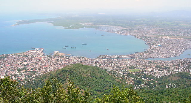
Title Image: The Northen part of Cap-Haitien, seen from Morne Jean. Source: Wikimedia Commons.
Further reading:
Dubois, Laurent. Avengers of the New World. Cambridge, MA: Belknap Press of Harvard University Press, 2004.
Fuentes, Marisa. Dispossessed Lives: Enslaved Women, Violence, and the Archive. Philadelphia: University of Pennsylvania Press, 2016.
Geggus, David. “The Major Port Towns of Saint Domingue in the Later Eighteenth Century” in Atlantic Port Cities: Economy, Culture, and Society in the Atlantic World, 1650–1850, edited by Franklin W. Knight and Peggy K. Liss, 87–116. Knoxville: University of Tennessee Press, 1991.
—. “Urban Development in Eighteenth Century Saint-Domingue.” Bulletin du Centre d’Histoire des Espaces Atlantiques5 (1990): 197–228.
—. “The Slaves and Free People of Color of Cap Français” in The Black Urban Atlantic in the Age of the Slave Trade, edited by Jorge-Cañizares- Esguerra. Philadelphia: University of Pennsylvania Press, 2016.
King, Stewart. Blue Coat or Powdered Wig: Free People of Color in Pre- Revolutionary Saint Domingue. Athens, GA: University of Georgia Press, 2001.
McClellan, James. Colonialism and Science: Saint Domingue and the Old Regime. Chicago: University of Chicago Press, 1992.
Popkin, Jeremy. You Are All Free: The Haitian Revolution and the Abolition of Slavery. Cambridge: Cambridge University Press, 2010.
Rogers, Dominique and Stewart King. “Housekeepers, Merchants, Rentières: Free Women of Color in the Port Cities of Colonial Saint-Domingue, 1750-1790” in Women in Port: Gendering Communities, Economies, and Social Networks in Atlantic Port Cities, 1500-1800, edited by Douglas Catterall and Jodi Campbell, 357-397. Leiden: Brill, 2012.
Socolow, Susan. “Economic Roles of the Free Women of Color of Cap Français,” in More Than Chattel: Black Women and Slavery in the Americas, edited by David Barry Gaspar and Darlene Clark Hine, 279-297. Bloomington, IN: Indiana University Press, 1996.
Endnotes:
[1] Dominique Rogers, “Réussir dans un Monde d’Hommes: les Stratégies des Femmes de Couleur du Cap-Français,” Journal of Haitian Studies 9, no. 1 (2003): 40-51; Luce-Marie Albigès, “Jean-Baptiste Belley, député de Saint-Domingue à la Convention,” Histoire par l’image, 2006, https://histoire-image.org/etudes/jean-baptiste-belley-depute-saint-domingue-convention; Hamy Ernest-Théodore, “Charles Arthaud, de Pont-à-Mousson (1748-1791). Courte notice sur sa vie et sur son œuvre, suivie de deux mémoires inconnus de cet observateur sur les anciens indigènes de Saint-Domingue,” Bulletins et Mémoires de la Société d’anthropologie de Paris 9 (1908): 295-314.
[2] They form part of the Dépôt des Papiers Publics des Colonies, or DPPC, held in the Archives Nationales d’Outre-Mer, located in Aix-en-Provence, France (ANOM, DPPC, 49-50).
[3] Some examples of use of the cadastre by historians Zélie Navarro-Andraud,”La résidence urbaine des administrateurs coloniaux de Saint-Domingue dans la seconde moitié du XVIIIe siècle,” Articulo – Journal of Urban Research, 2009, David Patrick Geggus, “Urban Development in Eighteenth Century Saint-Domingue,” Bulletin du Centre d’Histoire des Espaces Atlantiques, 5 (1990): 197‑228, Paul Butel, “Le modèle urbain colonial au XVIIIe siècle: l’investissement immobilier dans les villes de Saint-Domingue,” in Paul Butel, Louis Michael Cullen, eds., Cities and merchants: French and Irish Perspectives on Urban Development, 1500-1900 (Dublin : Trinity College, 1986).
[4] At this stage, our informational site streetsoflecap.com is available in French and English. We hope to add Haitian Kreyól to the next version of the site.
[5] For the duration of the Haitian War for Independence, French generals struggled to pay for the war and resorted to taking out loans from foreign nations, taxing the people, and requisitioning goods, among other unpopular tactics. See Philippe Girard, The Slaves Who Defeated Napoleon: Toussaint Louverture and the Haitian War of Independence, 1801-1804 (Tuscaloosa, AL: University of Alabama Press), chapter 6.
[6] The page of the 1803 cadastre that describes how these occupational classes are broken is torn, unfortunately. However, like the 1803 cadastre, a law that establishes a licensing fee that dates to 6 fructidor an IV does include a section that provides an occupational class breakdown (classes one through eight). Wholesale merchants of drapery, haberdashery, silk, cotton stuffs, linen, linen, muslin, gauze, and lace, for example, were members of the “first [occupational] class” while notaries, upholsterers, pastry chefs, and retail linen merchants were members of the “third [occupational] class.” See “Loi portant établissement d’un Droit de Patente, pour l’An cinq,” 6 fructidor, an IV, Log. 1989.Q, Library Company of Philadelphia.
[7] The cadastre includes a list of residents living in Haut du Cap as well as at La Fossette!
[8] Affiches Américaines, March 11, 1775 and May 17, 1777, Marronnage.info.
[9] ANOM 7 DPPC 7249, Termination of a company, May 14, 1780; ANOM 7 DPPC 7249, Lease of a bakery, May 15, 1780; ANOM 7 DPPC 7249, Will, June 13, 1780; ANOM 7 DPPC 7249, Lease of a bakery, June 18, 1788.
[10] The exact phrase in the record is “Folle et infirme.”
[11] Philippe Loupes, “Le modèle urbain colonial au XVIIIe siècle : la maison et l’habitat au Cap-Français et au Port-au-Prince,” in Paul Butel et Louis Michael Cullen, Cities and Merchants: French and Irish Perspectives on Urban Development, 1500-1900 (Dublin: Trinity college, 1986), 164‑179.
[12] Place Montarcher was in front of le Gouvernement, a large building that included rooms for the colonial governor, a library, chapel, courtrooms, and more. Starting in 1776, Place Montarcher was also home to the town’s new theatre. The description of Place Montarcher comes from James McClellan, Colonialism and Science: Saint Domingue and the Old Regime (Chicago: University of Chicago Press, 1992), 86-87, 95-96.
[13] Gauvin Alexander Bailey, Architecture and Urbanism in the French Atlantic: State, Church, and Society 1604-1830 (Montreal: McGill-Queen’s University, 2018), 262, 264. Baily writes that public monuments were designed to act as visual markers of the French state’s “power and technological accomplishments.”
[14] Marisa Fuentes, Dispossessed Lives: Enslaved Women, Violence, and the Archive (Philadelphia: University of Pennsylvania Press, 2016), 8. See esp. chapter 1. Rashauna Johnson, Slavery’s Metropolis: Unree Labor in New Orleans during the Age of Revolutions (New York: Cambridge University Press, 2016), 126, 127. See esp. chapter 4 on penal spaces. Despite late eighteenth- and early nineteenth-century reformers in Britain, the U.S., or France who came to see corporal punishment as anathema to a modern “civilized” society, enslavers continued to engage in the practice, torturing enslaved people of African descent.
[15] James McClellan calls eighteenth-century Saint-Domingue a veritable “armed camp” teeming with fortifications and military installations. These architectural elements were complemented by the presence of upwards of 1,300 French regulars at the nearby grandes casernes (barracks), by the mounted slave-catching Maréchaussée, and the 13-company standing militia composed—the milices. McClellan, Colonialism and Science, 41-43.
[16] Concept borrowed from Edward Said by Stephanie M. H. Camp, Closer to freedom: Enslaved Women and Everyday Resistance in the Plantation South (Chapel Hill: University of North Carolina Press, 2006), xvii-xviii.
[17] Thanks to a simple search of Lemesle’s name on Marronage.info., we located 11 announcements of marronage concerning the enslaved individuals owned by this family. The enslaved men and women who fled the Lemesle bakery are as follows: Alerte, absconded February 15, 1775; Baptiste and Pyrame absconded April 23, 1777; Pyrame absconded again around the end of July 1777; Marie-Rose gone for 18 months as of January 11, 1780; Baptiste, absconded April 10, 1782; Pirame, Charlot, and Pierrot, absconded May 21, 1782; Prince, absconded January 29, 1783; Rosalie, absconded November 1783; Paul, Rosalie, and Charlotte absconded in May 1784; (unknown) absconded August 1784; and Cupidon, absconded January 23, 1786. Jail lists from Affiches Américaines have not been consulted, but could add further insight into the fates of these individuals.
[18] Affiches Américaines, June 6, 1782.
[19] Affiches Américaines, May 5, 1783.
[20] Plan Directeur de la Ville du Cap et de ses Environs lev é sur une Echelle de 4 pounces pour cent Toise. Direction Général des Fortificat. Sr. Mansuy, Ing. en chef, Cabinet EM793/2 Ms Oversize. John Carter Brown Library.
[21] On the impact of the fire on the Haitian Revolution and slavery, see Jeremy Popkin, You Are All Free: The Haitian Revolution and the Abolition of Slavery (Cambridge: Cambridge University Press, 2010). On exiles in the United States, see especially Ashli White, Encountering Revolution: Haiti and the Making of the Early Republic (Baltimore: Johns Hopkins University Press, 2010).
[22] Cartulaire du Maisons de la ville du Cap, 135AP/4, Fonds Rochambeau (1746-1803), Archives nationales, Pierrefit-sur-Seine. ANOM, DPPC, G1/496, État nominative des contribuables de la ville du Cap.
[23] Charles Leclerc, Au Nom Du Gouvernement Français. Armée de Saint-Domingue. Arrêté Concernant la Reconstruction des Maisons du Cap, February 15, 1802, bE802.L462L, JCB. On the quick rebuilding of Le Cap, see Josiah Lewden and Robert Duhamel to William Lynch, February 19, 1802, Lewden and Duhamel Records (LDR), Am.997095, Historical Society of Pennsylvania, Thomas Essington to Manuel Eyre, July 13, 1802, Manuel Eyre Shipping Papers, Acc. 0994, Hagley Library. See also Leonora Sansay, Secret History; or, The Horrors of St. Domingo, in a series of letters, written by a lady at Cape Francois to Colonel Burr (Philadelphia: Bradford & Inskeep, Philadelphia, 1808), 5.
[24] ANOM, DPPC, G1/496, État nominative des contribuables de la ville du Cap. Nearby dwelling number 568 housed upwards of 30 people.
[25] Petit/e marchand/es were sometimes known to sell their wares by walking through the town. The 1803 cadastre delineates those who sold their goods in this fashion by indicating as such. For example, Marie Gaubert of 96 Ste. Catherine was described as a “marchande par les rues” while the occupation of Marie Noel of 369 Fermée was noted as “vend par les Rues.”
[26] ANOM, DPPC, G1/496, État nominative des contribuables de la ville du Cap.
Leave a Reply